
Real-Time Tracking
Historical Activity Reporting

Desktop & Mobile interface

Notifications & Alerts


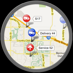
Real-time vehicle movement can be viewed on a variety of street or aerial image maps. Bing, Google or OpenStreetMaps are standard mapping options.

Where the mapping provides it, customers can view real- time traffic flow to dispatchers to estimate ETAs or make better routing decisions.

Easily add customer zones, find street addresses, and find closest vehicle to an address to assist dispatch vehicles and drivers.

All reports in the user interface can be downloaded into Excel, which allows for customization of the data and makes it easy to email reports within your organization.


Managing by exception is important. Use one of the preset rules or customize one for the end user. Examples range from accident detection to seatbelt policy management. Once a rule is made, you can create scorecard dashboards and reports.